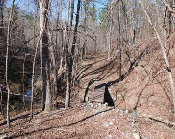
The walking bridge on the trail between the West Cabin and the forest road.
OMBS is a 600 acre natural area located in the Ouachita Mountains of the Interior Highlands. Elevation ranges from approximately 369 to 622 m. The area is a mixed pine hardwood forest depending upon the degree and orientation of the slope. Dominant tree species include shortleaf pine, post oak, black oak, blackjack oak, southern red oak, and sweetgum with dogwood, downy serviceberry, American hornbeam, eastern hophornbeam, and winged elm in the understory. Within a fifty mile radius several endemic species of organisms are found. The Rich Mountain salamander (Plethodon ouachitae) and the Caddo Mountain salamander (Plethodon caddoensis) are endemic to these mountains.
The OMBS has four marked trails and more will be developed as we have the opportunity. The trails are intended to provide better access to remote areas of the OMBS. The walking distance is from 15 minutes to 3 hours, depending on the trail or trails taken. A brief description of the trails is given below. We want the trails to be used so they will be more obvious and more easily maintained. Hikers are urged not to cut corners but to stay on the trails. For your studies you may go anywhere, but ingress and egress from your study area should use the trails as much as possible. This also makes it easier for us to find you in an emergency. We have radios available to use when you are working in any remote area of the OMBS.
Nature Trail — This is the shortest trail and is a loop. The upper end starts neat the office (Dogwood) and the lower end joins the main road at the dam of the lower (largest) pond. This trail follows the west edges of the three ponds (showing ecological succession) from the upper and oldest pond, the middle pond, and the lower (youngest and largest) pond.
Slate Mine Trail — This trail is best started from the east end of the dam of the large pond. The trail is flagged from the dam to the old road up the mountain. Follow the road to the saddle between the peaks and then follow flagging a short distance more to the old slate mine. The mine was abandoned in the 1920’s but is still evident from the slate rubble in front of the opening. The opening is a squarish pit will water in the bottom. The biological interest of the mine is its water. There, near the top of the mountain, the slate mine water hole is a water source year-round. .
South Mountain Trail — We will find a better name later. This marked trail starts in the saddle above the slate mine and proceeds westward along the mountain ridge and two peaks to the western edge of the property (east tract). Near the slate mine the trail is difficult to follow and is clogged with blackberry bushes and other tangles. Once through that area the trail is fairly well defined and can be easily followed. From the headquarters to the end of this trail is about an hour or more of hard hiking. Take water.
West Cabin Trail — This trail starts near Phoebe and is well-marked with flagging tape. The trail goes through a diversity of habitat and crosses several small creeks in a winding route across and up a valley to emerge at the West Cabin. This is a recently developed trail through rough terrain.
Extensive area permits tent camping. A spring-fed stream runs into three ponds in late stages of succession.
This is an excellent research and teaching site for graduate students, undergraduates, and faculty.
The walking bridge on the trail between the West Cabin and the forest road.
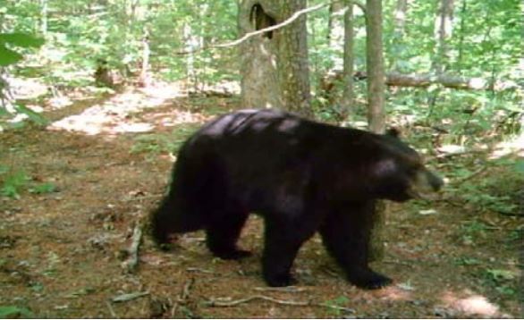
A bear on the West Cabin Trail at the saddle between
the mountains just east of the West Cabin.
The distinctive hole
in the tree identifies this spot; the bear probably will not be there.
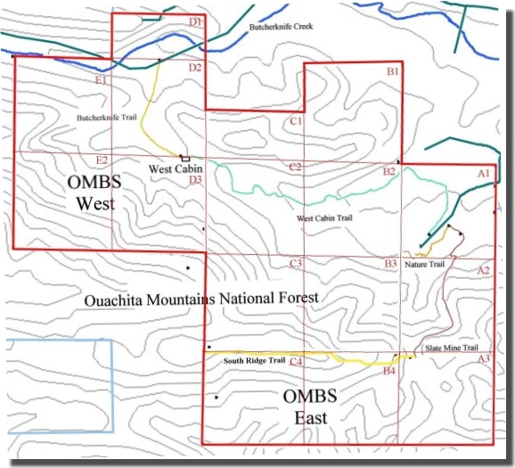
OMBS map with trails